Seabed digital twins beneath a floating offshore wind turbine
At SEM-REV, Cosma deployed three tetherless AUVs beneath FLOATGEN to map 2.6 ha of seabed, monitor biodiversity and support AI-assisted species mapping.

At the SEM-REV offshore test site, Cosma deployed three autonomous, tetherless underwater vehicles to map 2.6 hectares of seabed beneath and around the FLOATGEN floating wind turbine. The survey generated high-resolution digital twins to investigate interactions between floating offshore wind infrastructure and benthic ecosystems, support AI-assisted species detection and mapping, and establish a detailed baseline for long-term environmental monitoring.
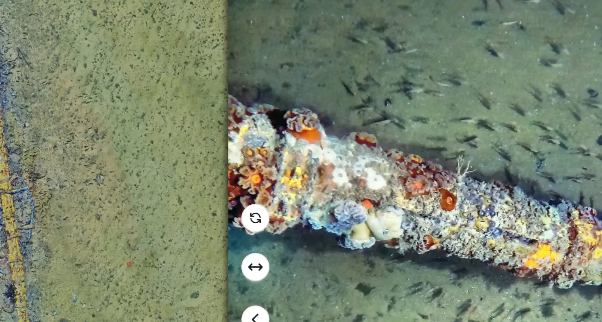
As part of the VELLELA environmental monitoring programme, Cosma conducted a high-resolution optical survey beneath FLOATGEN to better document the distribution of benthic communities and biological accumulations potentially associated with biofouling from the floating infrastructure. Previous video and sonar observations had identified several accumulation areas, but lacked the spatial resolution required to precisely characterise and map them.
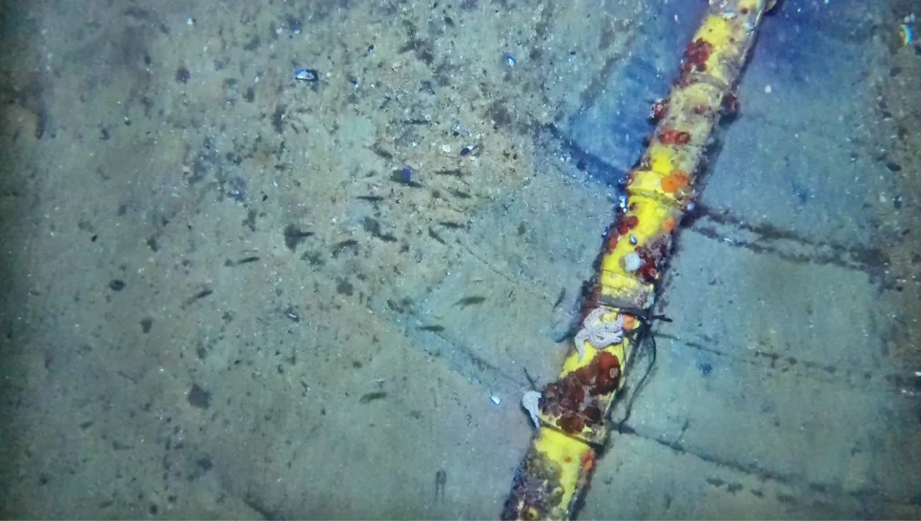
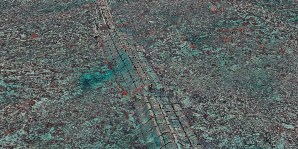
High-resolution ground-truth imagery of the dynamic cable, documenting biofouling communities and associated benthic fauna at millimeter-scale, as well as the trace created by the cable’s movement across the sediment.
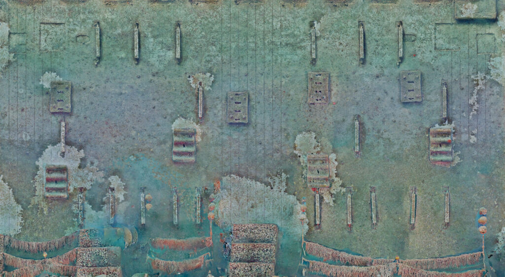
Three lightweight, tetherless AUVs operated simultaneously beneath and around the floating turbine, acquiring continuous georeferenced imagery despite the constrained environment created by the mooring lines, dynamic cable and navigation restrictions. The campaign covered 2.6 hectares of seabed, with the imagery processed into millimeter-scale 2D and 3D digital twins providing a spatially continuous view of the seabed and associated infrastructure. The survey also documented the dynamic cable touchdown point, a known vulnerable area where cable movement and seabed interactions can be monitored at high resolution.
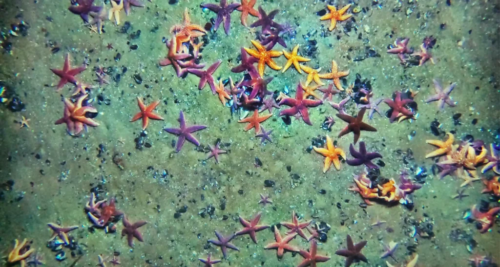
Dense starfish aggregations observed on the seabed beneath FLOATGEN, illustrating the biological patterns captured by the high-resolution optical survey.
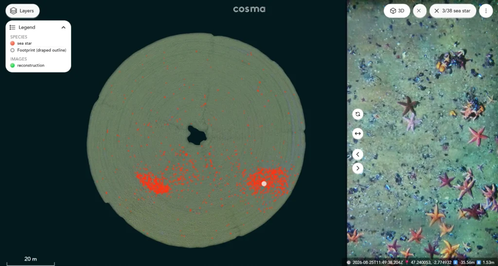
Automated detection and georeferenced mapping of starfish (Asterias rubens) across the digital twin, enabling their spatial distribution and abundance to be quantified at the scale of the surveyed area.
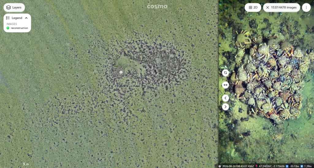
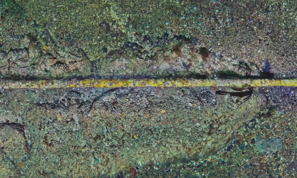
High-resolution digital twin revealing a dense biological accumulation on the seabed, with ground-truth imagery providing detailed observations of associated mussels and spider crabs (Maja brachydactyla).
The survey revealed biological accumulations predominantly composed of mussels, associated with aggregations of the spider crab Maja brachydactyla and starfish, including Asterias rubens and Marthasterias glacialis, and also documented the macrofauna colonising part of the subsea dynamic cable. Computer vision and AI-assisted species detection were applied to the high-resolution imagery to automatically detect and georeference organisms, including starfish, enabling their spatial distribution and abundance to be mapped across the surveyed area. Because the resulting datasets are precisely georeferenced, the same areas can be revisited and compared over time, enabling changes in benthic communities and biological accumulations to be quantified. Combined with the fully autonomous and tetherless AUVs, this approach can be deployed both before and after offshore structures are installed, supporting repeatable high-resolution environmental monitoring throughout different stages of a project’s lifecycle.
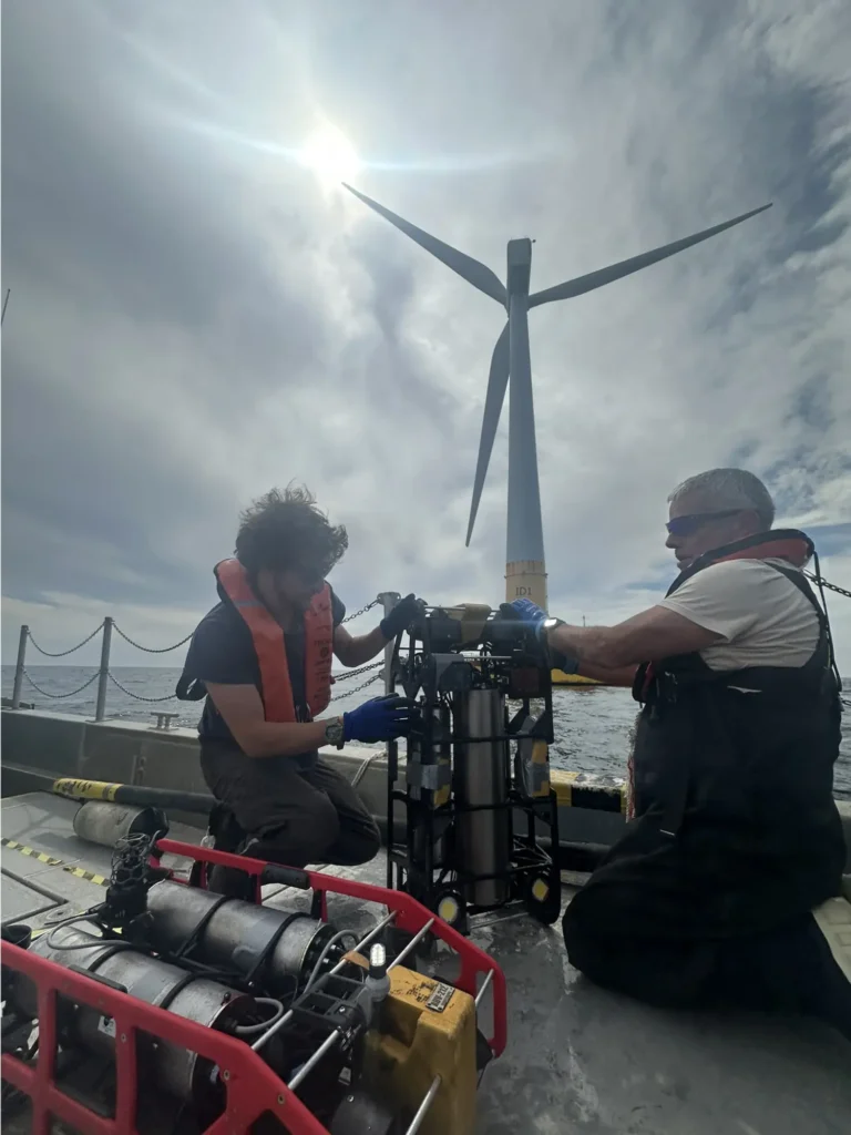
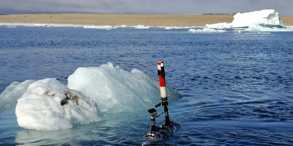
Deployment of Cosma’s man-portable AUVs at the SEM-REV offshore test site for high-resolution seabed mapping beneath and around the FLOATGEN floating wind turbine.
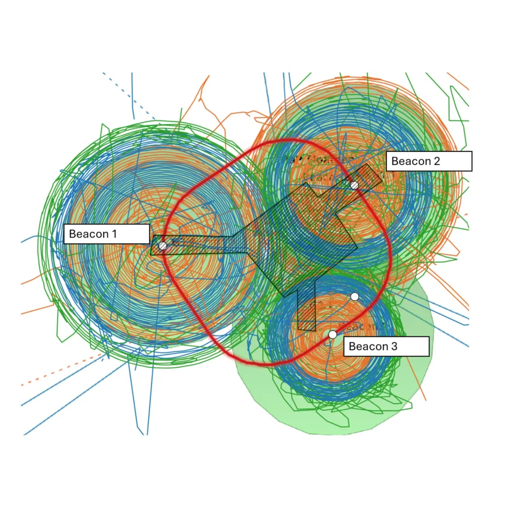
Three AUVs operated simultaneously to perform overlapping spiral surveys around FLOATGEN, enabling 2.6 hectares of seabed to be mapped despite the constraints imposed by mooring lines, the dynamic cable and navigation restrictions (no go zone in red).
Location SEM-REV offshore test site, 20 km off Le Croisic, France.
Client Fondation OPEN-C, within the VELLELA project, with Ifremer.
Objective Characterise the benthic habitats and biodiversity beneath the FLOATGEN floating wind turbine prototype operated by BW-IDEOL and investigate the potential biological connectivity between biofouling communities developing on the floating structure and the seabed.
Environment Soft-sediment seabed beneath an operating floating offshore wind turbine, with complex operational constraints including mooring lines, a dynamic cable and navigation exclusion zones.
Highlight Full coverage was achieved through multiple spirals executed from outside the no-go zone. Three autonomous, tetherless AUVs operated simultaneously over two days to map approximately 2.6 ha, generating high-resolution georeferenced 2D/3D seabed digital twins combined with AI-assisted computer vision for automated species detection and mapping.