Seabed mapping in strong currents and low-visibility conditions
At OPEN-C Paimpol, Cosma used multiple AUVs in strong tidal currents and low visibility to map benthic habitats and support environmental permit renewal.
At the OPEN-C tidal energy test site in Paimpol, Cosma conducted a high-resolution optical survey of the seabed and subsea cable to support the site’s environmental permit renewal. Operating in strong tidal currents and low-visibility conditions, multiple autonomous AUVs acquired georeferenced imagery to document benthic habitats, biodiversity and the subsea cable in a particularly challenging offshore environment.
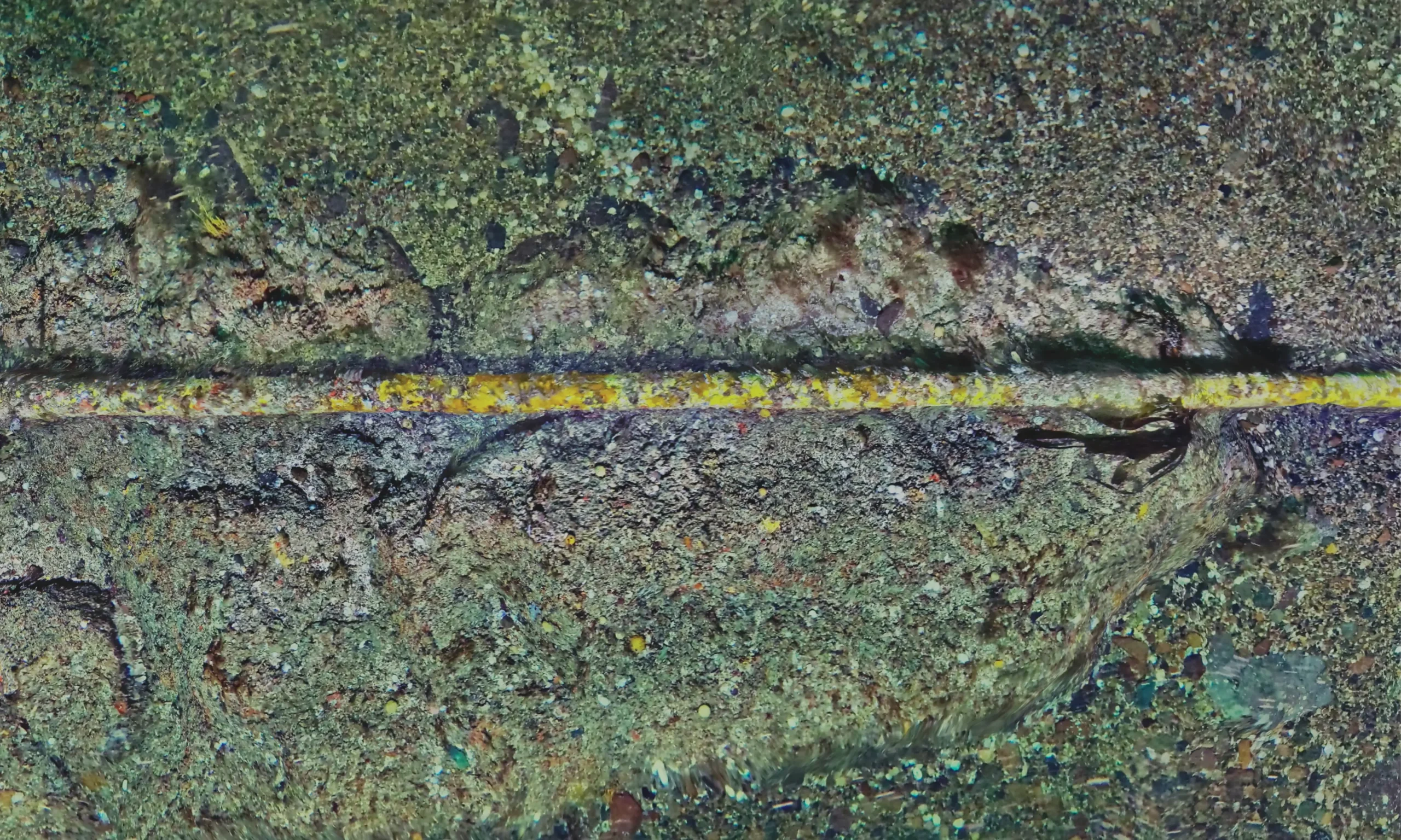
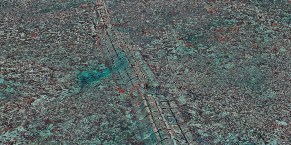
Detailed digital reconstruction of the subsea cable, documenting its position, biofouling and interactions with the surrounding rocky and coarse-sediment seabed.
As part of the environmental monitoring of the OPEN-C tidal energy test site in Paimpol, Cosma conducted a high-resolution survey to improve the characterisation of benthic habitats and communities and contribute to the site’s environmental permit renewal.
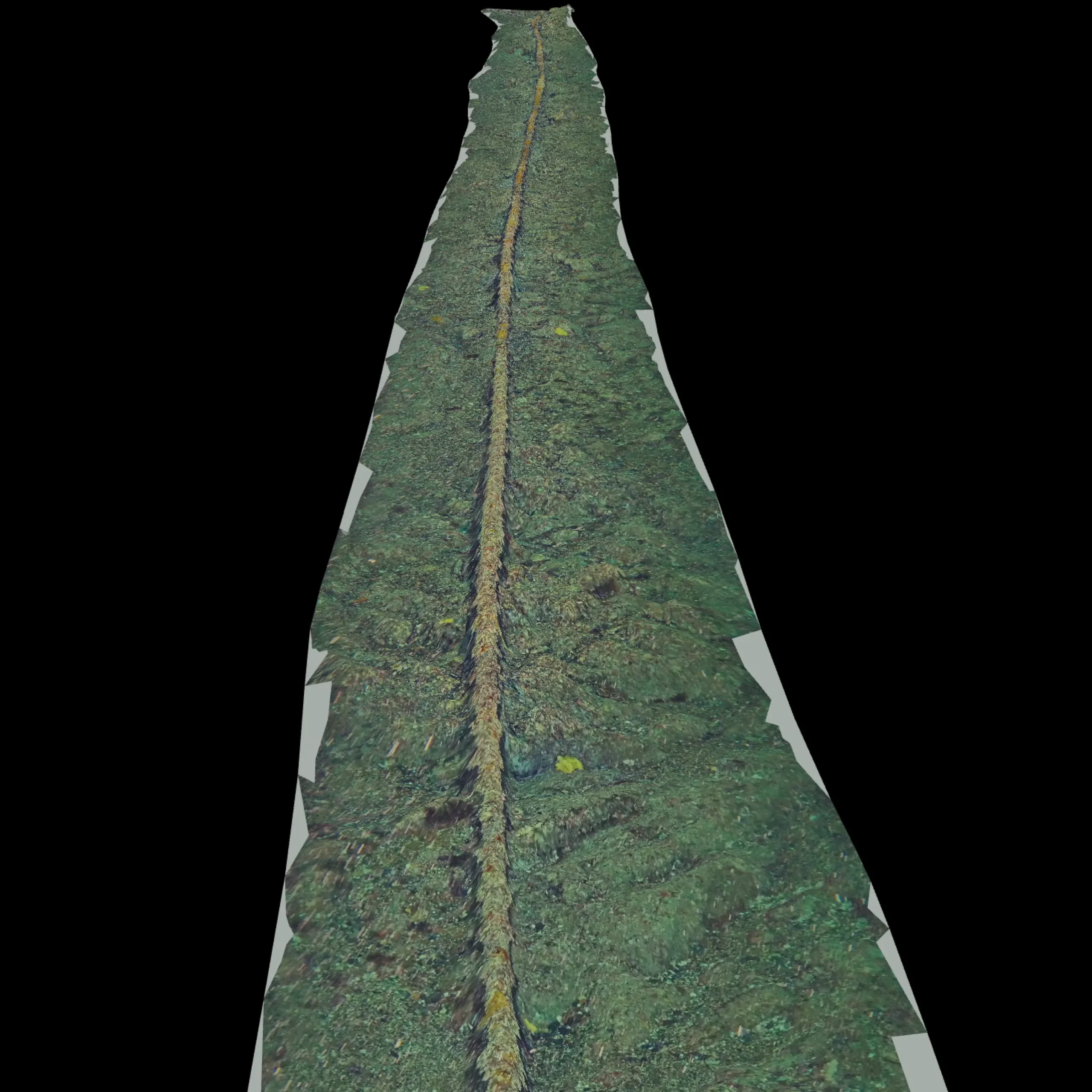
High-resolution 3D reconstruction providing a continuous spatial representation of the subsea cable and adjacent seabed.
The campaign demonstrated Cosma’s operational capability to deploy multiple autonomous AUVs simultaneously in a high-energy tidal environment, characterised by strong currents, low underwater visibility and depths exceeding 40 m.
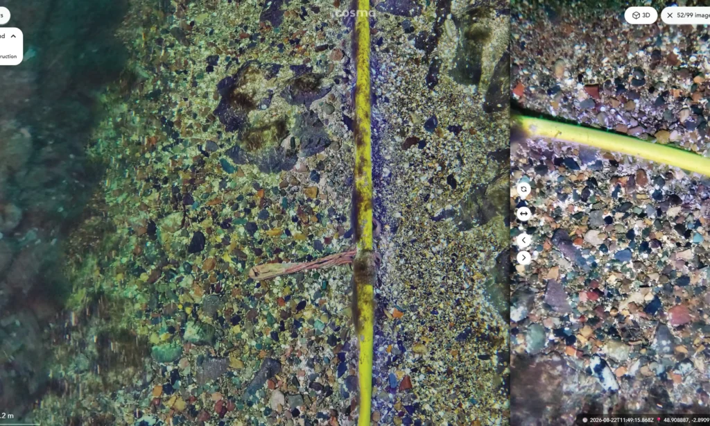
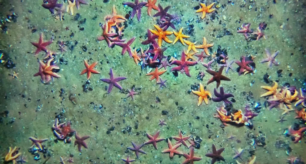
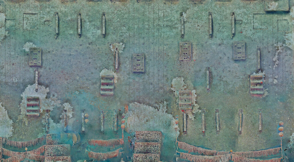
The acquired georeferenced imagery was processed into high-resolution 2D products and sparse 3D photogrammetric reconstructions, documenting representative seabed areas, the subsea cable and the diversity of natural and artificial substrates encountered. Computer vision and AI-assisted species detection were used to automatically detect and georeference benthic organisms across the surveyed areas. This approach enabled detailed environmental and infrastructure information to be acquired, analysed and delivered despite challenging offshore conditions.
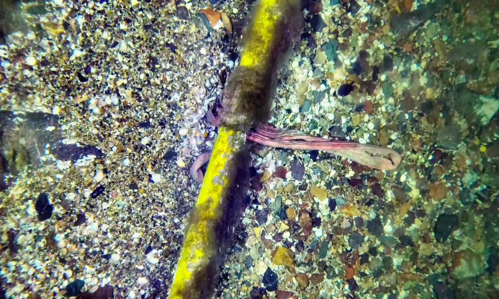
High-resolution imagery enables detailed inspection of the subsea cable and fine-scale characterisation of the surrounding substrate and benthic environment.
The datasets document heterogeneous rocky and coarse-sediment habitats, benthic fauna and biofouling communities developing along the cable. Together, these observations provide a detailed environmental baseline to support OPEN-C’s long-term monitoring of the site.
Location Paimpol-Bréhat tidal energy test site, Brittany, France.
Client Fondation OPEN-C.
Objective Characterise benthic habitats and communities to support the environmental permit renewal of the Paimpol tidal energy test site.
Environment High-energy offshore environment characterised by strong tidal currents, limited underwater visibility, heterogeneous rocky and coarse-sediment seabeds, and subsea infrastructure.
Highlight High-resolution georeferenced imagery and 3D reconstructions acquired under challenging tidal conditions, documenting benthic habitats, fauna and biofouling communities along the subsea cables.